How AI Transforms Border Surveillance Operations
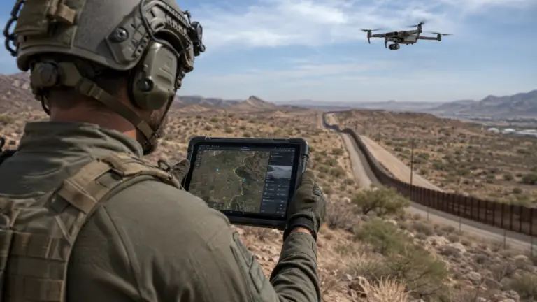
AI-powered drone navigation has fundamentally changed how security forces approach border surveillance. Where traditional drone operations required skilled pilots monitoring every meter of flight, today’s autonomous platforms execute complex multi-hour missions, adapt to environmental conditions, detect and classify threats in real time, and relay encrypted intelligence to command centers — all without continuous human control.
For border security commanders, defense procurement officials, and government security authorities, understanding this technology shift is no longer optional. It defines the capability gap between forces that control their borders and those that do not.
This guide examines the core AI and autonomy technologies driving the 2026 border surveillance landscape, the operational capabilities they unlock, and how ARMA GIDEON’s drone solutions are engineered to meet the demands of high-stakes perimeter security.
From Manual Control to Autonomous Mission Execution
The integration of artificial intelligence into unmanned aerial systems marks a generational shift in border security doctrine. Legacy drone programs relied on dedicated pilot teams, good visibility conditions, and manual target identification. These constraints imposed strict limits on patrol coverage, response time, and sustained operations.
Modern AI-powered drone navigation systems receive a mission brief — patrol corridor, threat reporting thresholds, return-to-base triggers — and execute without operator intervention. Onboard processing interprets sensor data, adjusts flight parameters in response to wind, terrain, and obstacle conditions, and prioritizes threat reporting based on pre-configured rule sets.
The operator shifts from a pilot to a mission commander. Instead of flying the drone, they analyze the intelligence the drone generates.
Machine Learning Threat Detection
The most operationally significant AI capability in border surveillance is machine learning threat detection. AI classification engines trained on large datasets of human movement patterns, vehicle signatures, and environmental baselines can distinguish a border crosser from a deer, a smuggling vehicle from farm traffic, and a stationary individual from vegetation movement — in real time, at night, at ranges exceeding the visual limit.
This capability eliminates a critical human factor limitation: alert fatigue. Human operators watching hours of drone footage eventually miss events. AI classification systems do not tire, do not lose concentration, and can monitor dozens of sensor feeds simultaneously. Alerts are generated only when the system identifies a genuine anomaly, allowing operators to focus their attention where it matters.
According to research published by Breaking Defense, AI-enabled autonomous surveillance platforms are now at the center of border security modernization programs across NATO member states and allied nations — with procurement demand accelerating sharply through 2026.
Autonomous Flight Capabilities That Change Operational Calculus
BVLOS Operations: Beyond Visual Line of Sight
BVLOS — Beyond Visual Line of Sight operations — is the foundational capability that makes AI-powered drone navigation valuable at strategic scale. A drone confined to visual line of sight covers a fraction of the patrol area a BVLOS platform can manage. A single BVLOS-capable UAV can maintain continuous coverage over 40–80 kilometers of border terrain on a single extended mission.
BVLOS operations require certified navigation autonomy. The drone must maintain positional awareness, avoid terrain and obstacles without pilot input, detect and de-conflict against other airborne traffic, and manage its energy reserves to execute a safe return before battery or fuel depletion. AI navigation stacks handle all of these functions in parallel, continuously.
AI-Driven Flight Paths and Adaptive Routing
Static patrol routes are a known vulnerability. Adversaries study them. AI-driven flight paths introduce mission variability that defeats route prediction. The system generates patrol corridors that achieve required coverage while randomizing timing, altitude, and specific path within defined operational parameters.
Adaptive routing goes further. When a sensor detects an anomaly, the navigation AI dynamically repositions the platform to improve sensor angle, maintain target tracking, or cue a secondary asset. The mission adapts in real time without waiting for operator instruction.
This capability is particularly valuable in complex terrain — wadis, mountainous borders, dense vegetation corridors — where fixed patrol routes create coverage gaps that experienced border crossers exploit.
Obstacle Avoidance Systems: Flying Without Risk in Contested Terrain
Autonomous obstacle avoidance is a prerequisite for BVLOS and night operations. A drone that cannot detect and avoid obstacles cannot safely fly without a pilot’s eyes on it.
LiDAR-Based Obstacle Avoidance
LiDAR (Light Detection and Ranging) is the gold standard for autonomous obstacle avoidance in complex environments. LiDAR sensors generate high-resolution three-dimensional maps of the surrounding airspace at ranges of 30–200 meters, enabling the navigation AI to identify and avoid terrain features, vegetation, power lines, and structures with high precision.
LiDAR-equipped platforms can fly safely at low altitude — a critical operational advantage for border surveillance, where flying low minimizes acoustic and visual signature while maximizing sensor resolution on the ground.
Multi-Sensor Fusion
Production-grade autonomous border surveillance platforms combine LiDAR with stereo optical cameras, ultrasonic sensors, and terrain-following radar. Sensor fusion means that no single sensor failure creates a mission abort condition. If one sensor layer is degraded — by weather, dust, or interference — the navigation system continues to operate on remaining inputs.
Multi-sensor fusion also enables performance in conditions that defeat single-sensor platforms: LiDAR degrades in heavy rain; optical cameras fail in darkness; ultrasonic sensors have limited range. A fused architecture performs reliably across the full operational environment.
Thermal Imaging and Night Operations
Border surveillance is a 24-hour requirement. Most cross-border activity by adversaries occurs at night specifically because darkness limits conventional surveillance. AI-powered drone navigation combined with thermal imaging eliminates this advantage.
Thermal Imaging Performance at Night
Thermal infrared sensors detect heat signatures regardless of ambient light conditions. A human body at a border crossing generates a distinct thermal profile against a cooler ground background. Vehicles, equipment, and recently used crossing points all retain thermal signatures that trained AI classification systems identify and flag.
ARMA GIDEON’s border surveillance drone platforms integrate calibrated thermal imaging payloads with onboard AI classification — enabling autonomous night patrol with real-time alert generation. No operator is required to watch video feeds continuously; the system watches and reports.
For technical specifications on thermal-capable platforms integrated into our border monitoring architecture, visit our Border Surveillance Solutions page.
Long-Range FPV Transmission and Command Architecture
Encrypted Long-Range FPV Transmission
Operational data — video, telemetry, sensor readings, threat alerts — must traverse long distances between the platform and the Ground Control Station. Long-range FPV transmission systems used in defense-grade border surveillance platforms operate on encrypted links using frequency-hopping spread spectrum and AES-256 encryption to defeat interception and jamming.
Link ranges of 50–100 kilometers are achievable with high-gain directional antennas and relay infrastructure. In extended-range operations, airborne relay nodes — mounted on higher-altitude surveillance platforms or tethered aerostats — extend data link coverage across entire border sectors.
Ground Control Station (GCS) Integration
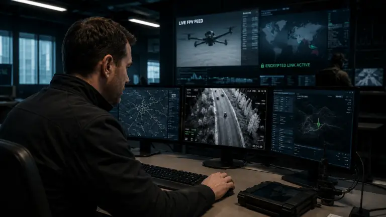
The Ground Control Station is the operational hub of an AI-powered border surveillance network. Modern GCS architectures are no longer simple pilot interfaces. They are mission management systems that aggregate feeds from multiple platforms, display AI-generated threat classifications on a fused common operating picture, manage tasking and route modifications, and archive mission data for post-event analysis.
Effective GCS design is built for commanders, not pilots. Threat alerts, confidence levels, sensor imagery, and recommended responses are surfaced automatically. The operator makes decisions; the system provides the intelligence basis for those decisions.
ARMA GIDEON’s VTOL Drone platforms are fully integrated with GCS architectures capable of managing multi-drone border patrol networks from a single command node.
BVLOS Operations in Practice: Real-World Border Surveillance Use Cases
Extended Perimeter Monitoring
A single AI-powered BVLOS drone can maintain a continuous patrol of a 50-kilometer border segment at low altitude, with thermal imaging and AI classification running continuously. Threat alerts are generated and transmitted to the GCS within seconds of detection. Response forces receive actionable intelligence — position, heading, number of individuals, presence of vehicles or equipment — without a human operator having watched the video.
Multiple drones operating on overlapping patrol corridors provide continuous coverage with no patrol gaps. When one platform reaches its energy threshold and returns for recovery, the adjacent platform expands its corridor to maintain coverage continuity.
Rapid Cue and Sector Response
When a fixed ground sensor — seismic, acoustic, or fence-based — detects an anomaly, a cued border surveillance drone can reach the location and establish overhead surveillance within minutes. The AI navigation system optimizes the transit route for speed while the thermal and optical payload begin classification immediately upon arrival.
The GCS presents the responding commander with a live overhead view, AI threat classification, and historical data from prior patrols of the same sector — before the ground response team is in position. This intelligence advantage changes the outcome of border interdiction operations.
Persistent ISR in Denied-Access Terrain
Some border sectors — steep mountain terrain, active mined areas, dense vegetation — are not safely accessible for dismounted patrol. AI-powered drone navigation enables persistent surveillance of these sectors without placing personnel at risk. The drone operates in terrain that humans cannot enter; the AI obstacle avoidance and navigation systems manage the flight safely.
For counter-UAV integration with border surveillance architectures — detecting and neutralizing drone intrusions across the same perimeter — see ARMA GIDEON’s Counter-UAV Systems page.
What to Evaluate in an AI Border Surveillance Drone System
For procurement officers and security commanders, the selection of an AI-powered border surveillance platform requires evaluation across several operational dimensions:
| Evaluation Criterion | What to Assess |
|---|---|
| BVLOS Certification | Regulatory approval status in the operational jurisdiction |
| AI Classification Accuracy | False positive rate, detection probability by threat category |
| Obstacle Avoidance Sensor Suite | LiDAR, optical, fusion architecture |
| Thermal Payload Performance | Resolution, range, AI integration |
| GCS Architecture | Multi-platform management, alert workflow, data archiving |
| Link Security | Encryption standard, frequency hopping, jamming resistance |
| Endurance and Range | Mission duration, patrol corridor coverage |
| Maintenance and Supportability | In-theater maintenance, spare parts, operator training |
No single platform scores highest on every dimension. Procurement decisions should be driven by the specific terrain, threat category, and operational tempo of the border sector in question.
ARMA GIDEON AI Drone Solutions for Border Security
ARMA GIDEON supplies AI-powered border surveillance drone systems to security forces and government authorities operating in demanding threat environments. Our platform portfolio covers the full spectrum of border security requirements: fixed-wing BVLOS platforms for long-corridor patrol, VTOL systems for rapid deployment and sector response, and integrated GCS architectures for multi-drone mission management.
All ARMA GIDEON drone solutions are engineered to defense procurement standards — not adapted from commercial products. Payloads, link architectures, and AI software stacks are selected and configured for operational environments where failure has consequences.
Our technical teams provide procurement consultation, site assessment, system integration, and operator training as part of every engagement. We do not sell hardware. We deliver operational capability.
Conclusion
The transformation of border surveillance through AI-powered drone navigation is not a future possibility — it is the operational baseline for serious security programs in 2026. BVLOS operations, machine learning threat detection, LiDAR obstacle avoidance, thermal imaging, encrypted long-range FPV transmission, and AI-driven flight paths are available now, proven in operational environments, and procurement-ready.
The question for border security commanders and defense procurement authorities is not whether to adopt AI-powered drone navigation — it is how to select, configure, and integrate the right system for their specific operational requirements.
ARMA GIDEON is ready to provide that consultation.
Contact ARMA GIDEON to discuss your border surveillance requirements.
Reach our defense procurement team at office@arma-gideon.com or through our secure contact portal. Initial consultations are confidential and obligation-free.